

Weather affects nearly every part of our daily lives, from commuting to work and planning vacations to protecting homes and staying safe during severe storms. While weather forecasts provide valuable predictions, they cannot always capture rapidly changing conditions. This is where local weather radar becomes one of the most important tools for monitoring the atmosphere in real time. Instead of showing what the weather might be hours from now, weather radar displays what is happening at the present moment and how weather systems are moving across a specific area.
Over the past few decades, weather radar technology has advanced significantly, allowing meteorologists to track rainfall, snowfall, thunderstorms, hail, and dangerous weather events with remarkable accuracy. Modern Doppler radar systems continuously scan the atmosphere and provide updated information every few minutes, helping weather experts issue timely forecasts and severe weather warnings. Today, millions of people use local weather radar through mobile apps, television broadcasts, and weather websites to stay informed about changing weather conditions. Understanding how weather radar works and how to interpret radar images can help anyone make smarter decisions, whether planning outdoor activities or preparing for severe weather.
What Is Local Weather Radar?
Local weather radar is a specialized system that uses radio waves to detect precipitation and monitor weather conditions within a specific region. The word RADAR stands for Radio Detection and Ranging, a technology originally developed for military purposes before becoming an essential tool in meteorology. Weather radar sends pulses of microwave energy into the atmosphere, and when these waves encounter rain, snow, hail, or other particles, part of the energy is reflected back to the radar station. Computers analyze these returning signals to determine the location, intensity, and movement of precipitation.
Unlike traditional weather forecasts that rely mainly on computer prediction models, local weather radar provides a real-time picture of current weather conditions. Meteorologists combine radar data with satellite imagery, temperature readings, humidity measurements, and atmospheric pressure observations to create accurate forecasts. Because radar updates every few minutes, it allows forecasters to monitor rapidly developing storms and issue warnings before dangerous weather reaches populated areas. This real-time capability makes local weather radar one of the most valuable tools in modern weather forecasting.
How Weather Radar Technology Works
Weather radar operates by transmitting short bursts of microwave energy into the atmosphere through a rotating antenna. As these waves travel through the air, they strike precipitation particles such as raindrops, snowflakes, sleet, or hailstones. A small portion of the energy bounces back toward the radar, while the rest continues traveling. The radar system measures the time it takes for the reflected signal to return, allowing it to calculate the exact distance to the precipitation.
Modern Doppler weather radar adds another important capability by measuring the movement of precipitation. Through the Doppler effect, meteorologists can determine whether rain or storm particles are moving toward or away from the radar station. This information helps identify wind patterns inside storms and detect rotating thunderstorms that may produce tornadoes. Advanced dual-polarization radar technology further improves accuracy by transmitting both horizontal and vertical radar waves, allowing forecasters to distinguish between rain, snow, hail, and debris. These technological improvements have greatly enhanced severe weather forecasting and public safety.
Why Local Weather Radar Is So Important
Local weather radar plays an essential role in protecting lives, property, and businesses. Severe weather can develop rapidly, leaving little time for preparation if people rely only on scheduled weather forecasts. Radar allows meteorologists to monitor storms continuously and detect changes in intensity or direction as they occur. This enables weather agencies to issue severe thunderstorm warnings, flash flood alerts, winter storm warnings, and tornado warnings much earlier than would otherwise be possible.
Beyond emergency situations, radar also supports everyday decision-making. People use local weather radar before commuting, traveling, exercising outdoors, attending sporting events, or planning family activities. Farmers monitor approaching rainfall to manage irrigation and harvesting, while airlines use radar information to help pilots avoid dangerous weather during flights. Construction companies, shipping businesses, and emergency response organizations also depend on radar to improve safety and reduce weather-related disruptions. The ability to see weather in real time gives individuals and organizations greater confidence when making important decisions.
Understanding Weather Radar Colors
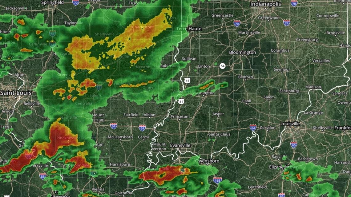
Weather radar images use different colors to represent the intensity of precipitation rather than temperature. Learning what these colors mean allows users to interpret radar maps more accurately. Although different weather services may use slightly different color scales, light green generally represents light rainfall, while darker green indicates steady rain. Yellow and orange often show moderate rainfall, suggesting heavier showers that may reduce visibility or create localized flooding if they persist.
As storms become stronger, radar images usually display red, dark red, purple, or even white shades. These colors often indicate extremely heavy rainfall, hail, or intense thunderstorm activity. In some radar systems, special colors or symbols identify snow, freezing rain, or mixed winter precipitation. Radar loops, which display several consecutive images, help users observe the direction and speed of storm movement. Instead of viewing a single image, watching radar animation provides a much better understanding of whether severe weather is approaching or moving away from a location.
Types of Weather That Radar Can Detect
One of the greatest advantages of local weather radar is its ability to detect many different forms of precipitation. Rain is the most common weather element displayed on radar, but modern systems can also identify snow, sleet, freezing rain, hail, and mixed precipitation. Dual-polarization technology has significantly improved the ability to distinguish between these different forms of moisture, making winter weather forecasting more accurate than ever before.
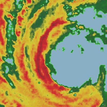
Weather radar is also an essential tool for tracking severe weather events. Meteorologists use radar to monitor thunderstorms, tropical storms, hurricanes, snowstorms, and intense rainfall capable of causing flash floods. Doppler radar can detect rotating air within thunderstorms, helping forecasters recognize conditions favorable for tornado development. While radar cannot directly observe every atmospheric feature, it provides critical information that helps experts understand storm structure and predict how dangerous weather systems are likely to evolve over the coming hours.
The Benefits and Limitations of Local Weather Radar
Local weather radar offers numerous benefits that make it one of the most trusted weather monitoring systems available. It provides continuous updates, often every few minutes, allowing users to follow changing weather conditions almost in real time. Radar data supports more accurate short-term forecasting, commonly known as nowcasting, which focuses on weather expected during the next few minutes or hours. This information is especially valuable during rapidly changing weather situations when traditional forecasts may no longer reflect current conditions.
Despite its many advantages, weather radar does have certain limitations. Radar beams travel in straight lines while the Earth curves, meaning the beam scans higher above the ground as distance from the radar station increases. Mountains, tall buildings, and other obstacles may also block radar signals, creating areas with reduced coverage. Occasionally, radar detects birds, insects, smoke, or dust instead of precipitation, requiring meteorologists to carefully analyze the data before issuing forecasts. Because of these limitations, radar works best when combined with satellite imagery, weather stations, computer models, and direct observations from trained meteorologists.
How Local Weather Radar Improves Daily Life
Many people check local weather radar before leaving home because it offers a more immediate picture of current weather than hourly forecasts alone. Drivers can determine whether heavy rain is approaching along their route, allowing them to adjust travel plans or leave earlier. Families use radar before visiting parks, beaches, or outdoor festivals, helping them avoid unexpected storms. Hikers, campers, and cyclists also benefit from real-time precipitation tracking that reduces the risk of getting caught in dangerous weather.
Businesses across many industries depend heavily on radar information. Farmers monitor rainfall to improve crop management, while delivery companies use radar to plan transportation routes during severe weather. Utility companies prepare for storms that may damage power lines, and emergency services rely on radar to coordinate disaster response. Schools, sports organizations, and event planners frequently monitor radar before making decisions about outdoor activities. By providing accurate and timely weather information, local weather radar supports both public safety and economic productivity.
The Future of Local Weather Radar
Weather radar technology continues to evolve as scientists develop more advanced methods for observing the atmosphere. Improvements in computer processing allow radar systems to analyze enormous amounts of weather data more quickly than ever before. Higher-resolution radar images provide greater detail about storm structure, rainfall intensity, and precipitation type, helping meteorologists produce increasingly accurate forecasts.
Artificial intelligence and machine learning are beginning to play a larger role in weather forecasting by identifying patterns within radar data that may be difficult for humans to recognize. Future radar systems are expected to deliver even faster updates, improved storm detection, and more precise rainfall estimates. These innovations will strengthen early warning systems, giving communities additional time to prepare for severe weather while improving the accuracy of everyday forecasts. As technology advances, local weather radar will remain one of the most important tools for understanding Earth’s constantly changing atmosphere.
Conclusion
Local weather radar has transformed the way people observe and respond to changing weather conditions. By providing real-time information about rainfall, snowfall, thunderstorms, hail, and storm movement, radar helps individuals make informed decisions while improving public safety. From everyday travel planning to life-saving severe weather warnings, radar technology has become an essential part of modern forecasting.
Although no weather system is perfect, local weather radar offers one of the most reliable ways to monitor current atmospheric conditions. When combined with satellite imagery, weather models, and professional meteorological analysis, it delivers highly accurate information that benefits families, businesses, emergency responders, and entire communities. As radar technology continues to improve through advanced sensors, artificial intelligence, and enhanced forecasting techniques, its role in protecting lives and supporting daily activities will only become more valuable. Whether you are checking for a passing rain shower or monitoring an approaching storm, understanding local weather radar allows you to stay prepared, make better decisions, and confidently navigate changing weather conditions.
